Calgary’s Inundation Model and Its Application to Project Denver’s Flood Risks
Click for Video Presentation:
Overview
This exercise applied geo-spatial machine learning to learn the inundation model in Calgary and predicted flooding hazard in another geography that is the city of Denver.
Motivation
To adopt a scientific approach for studying and predicting natural disasters; to
assist policy makers in the environment and infrastructure section to formulate adaptive
strategies; and to protect assets and finance of local residents.
Methodology & Algorithm
The data analysis exercise will take the following steps:
- Determining a city for comparison: Denver
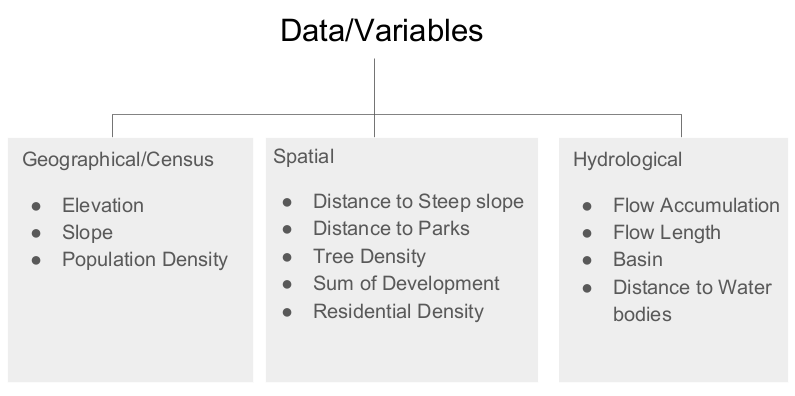
- Collecting data for Calgary and Denver
- Feature engineering
- Create fishnet
- Forward and Backward Selection for non-multicollinear criteria
- Logistic regression for significant factors
- Training vs Testing
- Model validation & cross validation
- Prediction on Denver
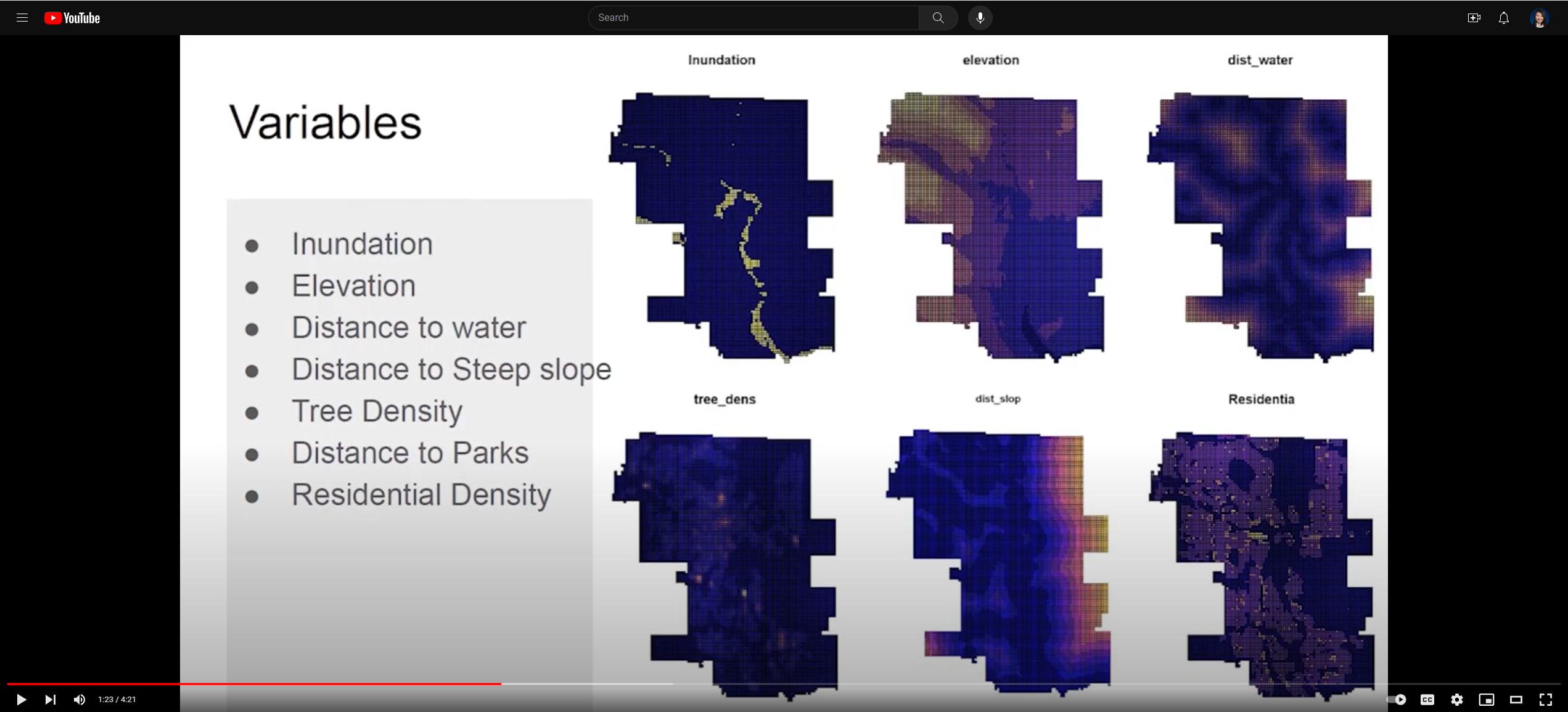
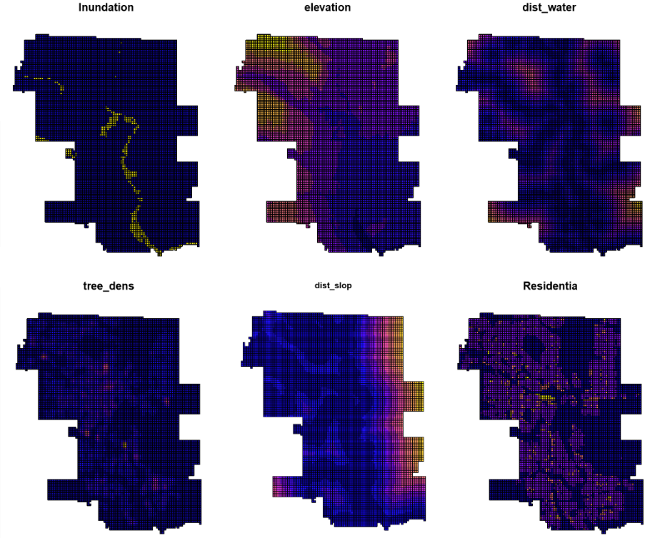
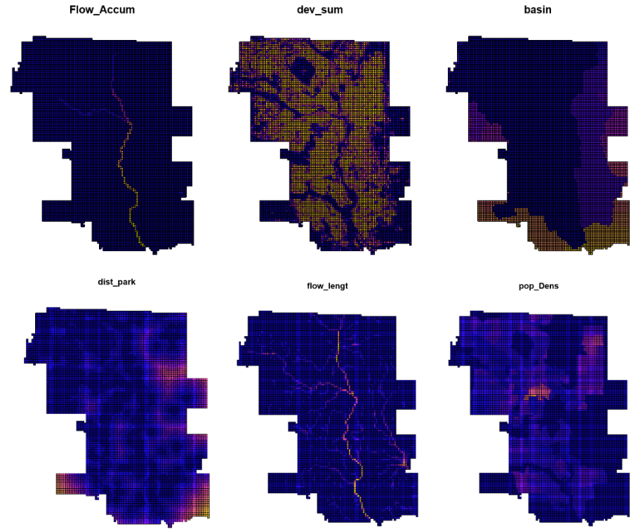
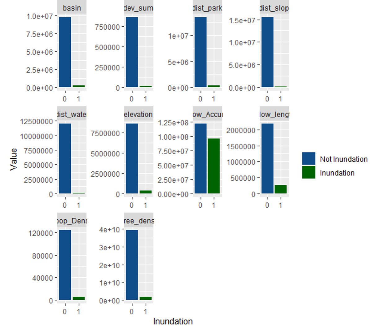
Variables
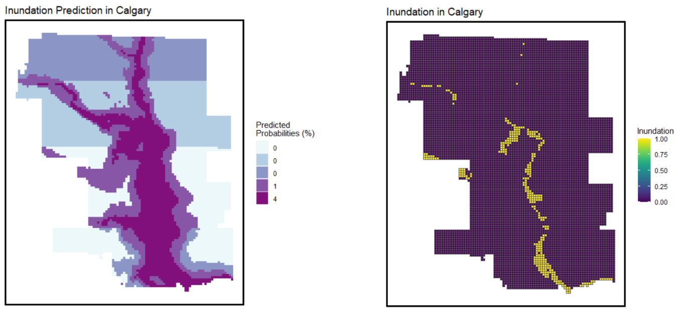
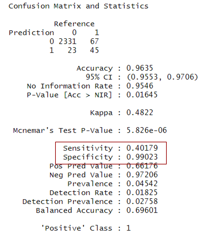
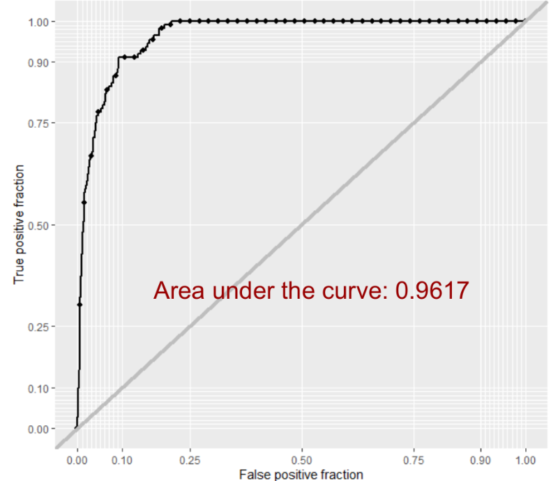
Confusion Matrix and ROC Curve
Prediction with Calgary Test Geography and Denvor